DJI Matrice 400 drone + DJI Care Plus 1 year

DJI Matrice 400 drone + DJI Care Plus 1 year

The DJI Matrice 400 stands out with a flight time of up to 59 minutes, a payload capacity of up to 6 kg, and an IP55 rating. This makes it ideal for even the most demanding tasks – it can be used in public safety, inspections, construction sites, and more. The drone is compatible with a wide range of modules, such as cameras, speakers, and lighting, so you can customize it to suit your specific operations. In addition, the DJI Matrice 400 is equipped with a rotating LiDAR sensor and mmWave radar, which allow it to accurately detect and avoid obstacles.


Included:

DJI Matrice 400 ×1
DJI RC Plus 2 Enterprise Enhanced controller ×1
DJI RC Plus 2 harness ×1
DJI Matrice 400 2510F propellers ×1
DJI Matrice 400 gimbal vibration isolator ×1
DJI Matrice 400 transport case ×1
LiDAR calibration cover ×1
Front propeller mount ×1
Rear propeller mount ×1
USB-C to USB-C data cable ×1
WB37 battery ×1
E-Port V2 rubber cap ×2
Rubber caps (2×2) ×4
Screw and tool kit ×1
Cleaning tools ×1

9 728.08 z VAT

Long flight time – even with a payload
The DJI Matrice 400 provides up to 59 minutes of flight time – even when flying with a light payload. This makes it ideal for firefighting, search and rescue missions, and large-scale mapping. What’s more, the drone can hover for around 53 minutes. In addition, the DJI Matrice 400 moves surprisingly fast and safely at the same time – flying at speeds of up to 25 m/s, it smoothly avoids obstacles such as mountains and buildings. It is ideal for demanding operations in difficult terrain!

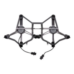
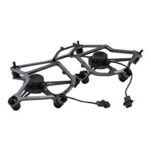
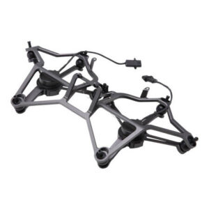
Payload capacity of up to 6 kg – compatibility with multiple modules
With a payload capacity of up to 6 kg, you can easily adapt the DJI Matrice 400 drone to your current operational requirements. The device is compatible with Zenmuse H30 and P1 series cameras, as well as the Zenmuse L2 laser scanner. You can also attach Zenmuse S1 lighting, Zenmuse V1 speaker, or modules from other manufacturers. Four external E-Port V2 ports allow you to mount up to seven payloads simultaneously.

Not afraid of difficult conditions
Operating in unfavorable conditions? No problem for the DJI Matrice 400! The drone has an IP55 rating, which means it is resistant to water and dust – it can operate without hindrance in rain or dusty environments. It is also not afraid of frost or heat – it operates without any problems in temperatures ranging from -20°C to 50°C.

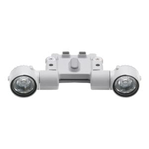
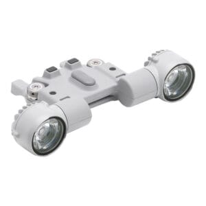
Detection of even small obstacles
The drone uses an advanced obstacle detection system that integrates a rotating LiDAR sensor, high-precision mmWave radar, and a set of fisheye sensors optimized for low-light conditions. This allows it to effectively detect various types of obstacles, including high-voltage power lines, even in darkness, rain, or fog. All this translates into unmatched flight safety regardless of conditions!

Reliable video transmission
Ten antennas mounted on the drone, a high-gain antenna system in the control equipment, and O4 Enterprise Enhanced Video Transmission System technology ensure stable video transmission at distances of up to 20 km. The DJI Matrice 400 also supports the sub2G frequency band, and when combined with two separately sold DJI Cellular Dongle 2 devices, it can automatically switch to a better network, ensuring a stable signal even in adverse conditions. In addition, the built-in transmission relay module allows the device to serve as a relay drone for other unmanned aerial vehicles, significantly extending the range of operation. This solution is ideal for search and rescue missions, as well as inspections in mountainous areas.

Stable and safe flight
Rotating LiDAR, mmWave radar, and fisheye sensors ensure precise obstacle detection in all directions and reliable positioning. Thanks to them, the drone guarantees stable flight even near structures with glass facades or wind turbine blades. It is also possible to return safely from the edges of buildings or bridges, even in situations where the return point has not been updated. Also noteworthy is the full-color vision assistance system, which increases the safety of every operation.

Several flight modes to choose from
Use the available modes to further streamline each operation. In Cruise mode, you can fly the drone in a specific direction without constantly pressing the control sticks, making it easier to fly long distances or perform linear inspections. The FlyTo feature allows the DJI Matrice 400 to automatically adjust its route and speed based on the surrounding environment, allowing it to reach its destination without manual adjustment. Smart Track, on the other hand, allows for precise tracking, automatic zoom adjustment, and easy switching between objects. The drone can automatically redetect the target even if it is temporarily obscured! There is also a POI mode that allows for continuous observation and 3D modeling of buildings while orbiting over a designated area.

Smart features to make your work easier
When paired with a Zenmuse H30 series camera, the DJI Matrice 400 drone can detect vehicles, ships, and other objects, for example during search and rescue operations or routine surveillance. In addition, the device offers high-resolution photography and allows for smooth tracking of designated targets. Advanced AR features are also available. Power Line AR displays lines on the camera screen showing obstacles in the form of wires, Map View AR shows the names of buildings and landmarks in real time, and AR Flight Waypoint displays the flight path during RTH, obstacle avoidance, or FlyTo operations. It is also possible to mark points on the controller display or outline areas to calculate their size. Measurement results can be synchronized with DJI FlightHub 2.

Even more possibilities
The DJI Matrice 400 supports Real-Time Terrain Follow, allowing it to follow the terrain in any horizontal direction. During search and rescue operations, the size of ground objects can be kept constant on the controller screen, reducing the need for frequent zoom adjustments and improving efficiency. During mapping missions, it is possible to maintain a constant ground sampling distance (GSD) to obtain highly accurate data. What’s more, the drone can easily take off and land on ships, making it ideal for maritime patrols (it can land on moving ships and take off from stationary vessels).

Automatic operations
When paired with the Zenmuse L2 LiDAR add-on module, the drone can perform automated flights along transmission and distribution lines. It uses a rotating LiDAR to detect obstacles in real time. In addition, the DJI Matrice 400 supports inclined and geometric route planning using DJI Pilot 2 or DJI FlightHub 2. This allows it to acquire precise data – necessary, for example, for detailed aerial measurements of building facades or for mapping selected structures.

Additional capabilities – accessories and software
Enhance every operation with additional accessories. The DJI Matrice 400 is compatible with the D-RTK 3 station and the DJI Cellular Dongle 2, which enables video transmission via 4G networks. In addition, the drone works with DJI FlightHub 2 software for operations management, DJI Terra for 2D and 3D reconstruction, and DJI Modify for model editing. It also supports PSDK, MSDK, Cloud API, and model training tools, all of which further extend its functionality. The DJI Matrice 400 also guarantees data security, offering AES-256 encryption and Local Data Mode, in which the device operates completely offline.

DRONE
Takeoff weight (with propellers) Without batteries: 5020±20 g;
With batteries: 9740±40 g;
*Actual weight may vary depending on batch of materials and external factors.
Maximum takeoff weight 15,8 kg
Dimensions Unfolded, with landing gear: 980×760×480 mm;
Folded, with landing gear and gimbal: 490×490×480 mm;
*Maximum dimensions without propellers
Transport case dimensions 779×363×528 mm
Max. lifting capacity 6 kg
*Measurement taken at the third gimbal joint at sea level. Lift capacity decreases with altitude.
Propeller size 25 inches
Wheelbase diagonally 1070 mm
Max. climb rate 10 m/s
Maximum descent speed 8 m/s
Max. horizontal speed (at sea level, no wind) 25 m/s
Maximum takeoff altitude 7000 m
Maximum flight time (without wind) 59 min
*Measured at a flight speed of 10 m/s, in a windless environment, at sea level, with no payload other than the H30T (weight 10,670 g), from 100% to 0% battery level. Actual time depends on environment, usage, and software version.
Maximum hover time (no wind) 53 min
*Measured during hovering, with H30T (weight 10,670 g), in a windless environment, at sea level, from 100% to 0% battery. Actual time depends on flight mode, accessories, and environment.
Maximum flight range (without wind) 49 km
*Measured at a constant speed of 17 m/s, in a windless environment, at sea level, without additional load, from 100% to 0% battery. Actual results vary depending on environment, usage, and software.
Max. wind resistance (takeoff/landing) 12 m/s
Max. angular velocity of the yaw axis 100°/s
Max. angle of inclination 35°
Operating temperature range From -20°C to 50°C (without solar radiation)
GNSS system GPS + Galileo + BeiDou + GLONASS
*GLONASS only works with the RTK module active.
ADS-B In Built-in ADS-B In receiver and dual antennas, range up to 20 km
Hover accuracy range (in moderate wind or no wind) Vertical:
±0.1 m (with vision positioning), ±0.5 m (with satellite positioning), ±0.1 m (with RTK positioning);
Horizontally:
±0.3 m (with visual positioning), ±0.5 m (with satellite positioning), ±0.1 m (with RTK positioning);
GNSS RTK positioning accuracy RTK Fix: 1 cm + 1 ppm (horizontal), 1.5 cm + 1 ppm (vertical)
RTK direction accuracy Supports RTK course with accuracy better than 2°
Ports USB-C debug ×1 (USB 2.0),
E-Port V2 ×4 (bottom of the drone, with 120 W power per port),
Cellular Dongle 2 interface ×2 (on the bottom of the drone)
Propeller model 2510F
Signal light Built into the drone
Water/dust resistance IP55
*The protection rating may decrease as a result of product wear and tear.
Gimbal connectors
Maximum load per gimbal joint 1400 g
*If the value of 1400 g is exceeded, the service life of the gimbal shock absorber is reduced from 1000 to 400 hours.
Maximum load capacity of the dual gimbal connector 950 g
Maximum load capacity of the third gimbal connector 3 kg with quick release, 6 kg with screw mount
Detection system
Detection system type Omnidirectional dual optical system (RGB Full Color optical sensors with fisheye lenses);
Rotating horizontal LiDAR, top LiDAR, and downward-facing 3D infrared distance sensor;
Six-direction mmWave radar
Front Measuring range: 0.4–21 m;
Detection range: 0.4–200 m;
Field of view (FOV): 90° (horizontal), 90° (vertical);
Rear Measuring range: 0.4–21 m;
Detection range: 0.4–200 m;
Field of view (FOV): 90° (horizontal), 90° (vertical);
Side Measuring range: 0.6–21 m;
Detection range: 0.5–200 m;
Field of view (FOV): 90° (horizontal), 90° (vertical);
Down Measuring range: 0.5–19 m;
Field of view: 160° forward and backward, 105° to the right and left;
Work environment Front, back, left, right, and top:
smooth surface texture, adequate lighting;
Bottom: surface with distinct texture and adequate lighting conditions*, with diffuse light reflection and a reflectance coefficient above 20% (e.g., walls, trees, people, etc.)
*Suitable lighting conditions mean light intensity no lower than in an urban night scene.
Rotating LiDAR Standard measuring range: 0.5–100 m @ 100,000 lux with a target reflectance of 10%;
Measuring range for power lines: 35 m @ 30° @ 10,000 lux for a 21.6 mm steel-aluminum conductor at a 30° angle to the left and right;
Field of view (FOV): 360° (horizontal), 58° (vertical);
Point frequency: 520,000 points/second;
Laser wavelength: 905 nm;
Eye safety class: Class 1 (IEC60825-1:2014), safe for the eyes;
Upper LiDAR (3D ToF) 0.5–25 m at night (reflectivity>10%);
Field of view up and down: 60°, right and left: 60°
Lower three-dimensional infrared sensor Measuring range: 0.3–8 m (reflection coefficient>10%);
Field of view forward and backward: 60°, right and left: 60°;
mmWave radar Measuring range for power lines:
36 m for 12.5 mm steel-aluminum cable,
50 m for 21.6 mm steel-aluminum cable;
Field of view (FOV): ± 45° (horizontal and vertical)
*The mmWave radar function is not available in some countries/regions.
FPV camera
Resolution 1080p
Field of view (FOV) DFOV: 150°;
HFOV: 139.6°;
VFOV: 95.3°;
Frame rate 30FPS
Night mode Starlight class
Broadcast


Video transmission system DJI O4 Enterprise Enhanced Video Transmission System
Live preview quality Control equipment: 3 channels, 1080p/30FPS
Operating frequency and transmitter power (EIRP) 902–928 MHz: <30 dBm (FCC), <16 dBm (MIC);
1.430–1.444 GHz: <35 dBm (SRRC);
2.4000–2.4835 GHz: <33 dBm (FCC), <20 dBm (CE/SRRC/MIC);
5.150–5.250 GHz: <23 dBm (FCC/CE);
5.725–5.850 GHz: <33 dBm (FCC), <14 dBm (CE), <30 dBm (SRRC);
*The permitted operating frequency range varies depending on the country and region. Check local regulations.
Maximum transmission range (unobstructed, no interference) 40 km (FCC); 20 km (CE/SRRC/MIC);
*Data measured in an unobstructed and interference-free environment. Applies to one-way flights without return.
Maximum transmission range (with interference) Strong interference (dense buildings, residential areas, etc.): approx. 1.5–6 km;
Medium interference (city outskirts, city parks, etc.): approx. 6–15 km;
Weak interference (open spaces, remote areas, etc.): approx. 15–40 km;
*Data according to FCC standards under typical conditions for a given level of interference. For reference only and does not guarantee coverage.
Maksymalna prędkość pobierania Tryb standardowy: 80 Mb/s Downlink;
Playback: <25 MB/s;
Single-Channel Bitrate: ≤12 Mb/s;
*Dane uzyskane przy bliskiej odległości drona i kontrolera, bez zakłóceń.
Antennas WLAN antenna ×8: 6 antennas with vertical polarization and 2 with horizontal polarization;
Sub2G antenna ×2: 2 antennas with vertical polarization;
4G antenna ×4; Operating mode: 2T4R
Other Supports dual control mode and 2-channel Cellular Dongle 2
Akumulator


Model TB100
Capacity 20,254 mAh
Nominal voltage 48.23 V
Max. charging voltage 54.6 V
Cell type Li-ion 13S
Energy 977 Wh
Weight 4720 ± 20 g
Charging temperature From 5°C to 45°C
Discharge temperature From -44°F to 157°F
Battery heating Single battery: supported;
Onboard: supported;
Charging station: supported;
Discharge factor 4C
Max. charging power 2C
Low-temperature charging Supports self-heating during low-temperature charging
Number of cycles 400