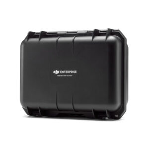
Set contents:
Zenmuse P1 camera with 35mm lens
DJI Care Enterprise for 1 year
Suitcase


Set contents:
Zenmuse P1 camera with 35mm lens
DJI Care Enterprise for 1 year
Suitcase
€6 301.77 z VAT
Available on backorder
Zenmuse P1 – a new quality of measurements
Zenmuse P1 integrates a full-frame sensor with interchangeable fixed-focus lenses on a 3-axis stabilized gimbal. Designed for photogrammetric flights, it -takes performance and accuracy to a whole new level.
Extraordinary performance
Zenmuse P1 features a full-frame, low-noise, high-sensitivity sensor that can take snapshots every 0.7 seconds during flight and cover 3 km2 in a single flight.
Remarkable accuracy
Featuring a mechanical shutter and an all-new TimeSync 2.0 system that synchronizes time between modules at the microsecond level, the Zenmuse P1 allows users to capture centimeter-precise data combined with real-time position and orientation compensation technology.
Incredible versatility
Create 2D, 3D models thanks to the integrated 3-axis gimbal that can be equipped with 24/35/50 mm lenses and the Smart Oblique Capture function.
Performance that covers everything – full frame camera:
Flexibility and versatility, multitude of lenses:
Smart Oblique Capture
Cover 7.5 km2 of area in one working day with Zenmuse P1. Elevate the efficiency of your photography mission with Smart Oblique Capture, where the gimbal automatically rotates to capture photos from various angles needed. Only the photos necessary for reconstruction will be taken from different angles of the flight area, which will increase post-processing efficiency by 20% to 50%.
Intelligent data management
Managing your mission data is streamlined like never before.
Field work report
Check data quality immediately after flight, verifying position data and the number of images acquired, as well as RTK status and positioning accuracy.
Mission mode for every scenario:
Usage:
| Brand | DJI |
| Model | CP.ZM.00000136.01 |
| Weight | 787 g |
| Dimensions | 198×166×129 mm |
| Power | 13 W |
| IP | IP4X |
| Compatible Drones | Matrice 300 RTK |
| Operating Temperature | -20° to 50° C |
| Storage Temperature | -20° to 60° C |
| Accuracy | Horizontal: 3 cm, vertical: 5 cm * * GSD mapping mission of 3 cm and flight speed of 15 m/s, with 75% front coverage and 55% side coverage |
| Display Size | 35.9×24 mm (full frame), Matrix size (Video mode size): 34×19 mm Pixels: 45MP Pixel size: 4.4 μm |
| Compatible Lenses | DJI DL 24mm F2.8 LS ASPH (with lens hood and balance ring), FOV 84° DJI DL 35mm F2.8 LS ASPH (with lens hood and balance ring), FOV 63.5° DJI DL 50mm F2.8 LS ASPH (with lens hood and balance ring), FOV 46.8° |
| Compatible SD Cards | SD: UHS-1 or higher; max capacity: 128 GB |
| Files | Photographs / GNSS observation files / Log files |
| Photo Size | 3:2 (8192×5460) |
| Photo Modes | Capture, Record, Playback |
| Minimum Photo Interval | 0.7 s |
| Shutter Speed | Mechanical: 1/2000-1/8 s Electronic: 1/8000-8 s *Aperture value not greater than f/5.6 |
| Video Format | MP4 |
| Resolution | 16:9 (3840×2160) |
| Number of Frames | 60fps |
| Stabilization | 3-axis (tilt, roll, pan) |
| Vibrations | 0.01° |
| Installation | DJI Skyport |
| Rotation Range | Tilt: -125° to +40°; Roll: -55° to +55°; Pan: ±320° |